
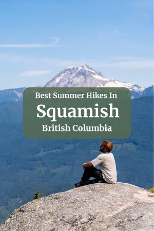
What Makes These The Best Summer Hikes In Squamish

I would argue that there is no definitive 'Best Summer Hike in Squamish'. Inevitably, when a friend from out of town comes to visit, they will eventually ask me to take them on a hike. Naturally, I want to show them the best of what Squamish has to offer, but I also need to tailor it to that friend specifically.
Some would hate me if I forced them to sweat the whole way up the Chief; others would see the view from the top as the highlight of their visit.
One of my friends loves more of a 'secret spot' so I took him down the valley road and up to Crooked Falls.
And with friends who just want a bit of whimsy, I'm taking them straight to Alice Lake Park for some of the best forest walks in town.
This isn't a ranked list. Instead, it's a collection of some of my favourite summer hikes in Squamish, and instead of directly rating them, I suggest which trail matches with which kind of experience you're looking for. Because it's less about picking the perfect trail, and more about picking the perfect trail for you and your group that day.
For the Summit Views: The Stawamus Chief

| Distance | Elevation | Time | Type | Difficulty |
|---|---|---|---|---|
| 4 km | 557 m | 3 h | out and back | hard |
Trail Map
Let's get the obvious one out of the way first. The Chief is Squamish's most famous hike for a reason. It's a 700-meter granite monolith that looms over the town and offers some of the most spectacular views in the Sea-to-Sky corridor.
It is a short and straightforward trail, but it is a brutal grind. You are climbing man-made and naturally formed stairs essentially the whole way, except for a stretch near the peak. Up there, it's so steep you switch from stairs to ladders.
If you pack lots of water and give yourself lots of time for breaks, you will make it up no problem, and the views from the top are worth every drop of sweat.
There are 3 different peaks you can climb to. First Peak is the most popular, and it's what I would suggest for anyone who is just visiting for the day. Second and Third Peak are completely separate from the first peak, meaning you have to choose the peak you want to climb to before you start the trail.
For more details on the different routes available, check out our Dedicated Stawamus Chief Hiking Guide.
For the Alpine Experience: Watersprite Lake

| Distance | Elevation | Time | Type | Difficulty |
|---|---|---|---|---|
| 17.4 km | 710 m | 8 h | out and back | hard |
Trail Map
If The Chief is about earning a view in a couple of gruelling hours, Watersprite Lake is the hike for when you want to go bigger and turn it into a proper backcountry mission. This one takes you deep into the mountains outside Squamish to a stunning sub-alpine lake, glacier-fed, impossibly clear, and ringed by dramatic peaks.
This is a moderate to challenging hike, climbing about 715 metres over 8.5km each way. Budget 4 to 5 hours going up and 3 to 4 coming down, so it's a full day commitment at the minimum, and a lot of people turn it into an overnight instead. The first 4km are a gradual, narrow forest path without much to look at, then the climb steepens, and the views start opening up into the Squamish Valley. The last 1.5km are the real test, with two rockfall sections to navigate, the second a steep, boulder-strewn 45% grade that's brutal if you're carrying a full camping pack.
Here's the part that surprises a lot of people though: the trail isn't actually the only challenging part of this trip.
The road is brutal as well. You'll turn onto the Mamquam River Service Road just before Squamish and follow it about 20km to the trailhead. The first 10km are manageable in almost any vehicle, but the last few kilometres get rough, potholes, narrow bridges, and deteriorating gravel that will have you white-knuckling the wheel. A 4x4 is strongly recommended, or at minimum, a vehicle you're not too precious about.
If you're planning to camp, you'll need to book a tent pad in advance through the BC Mountaineering Club, around $20 CAD, with pre-assigned wooden pads, bear-proof storage, and an outhouse near camp. Summer dates fill up months ahead, though cancellations do pop up if you keep an eye on availability. Day hikers don't need a permit at all, just a spot in the parking lot.
One tip that makes a real difference: the lake shades over by around 4:30 pm even in peak summer, so if swimming in the sun is the goal, get there early. When you reach the end of the trail, you'll hit a fork with paths to the outhouse, the lake, and the camp, in that order. Take the lake first. That spot delivers the iconic view out to the surrounding peaks, and it's worth the swim before continuing the extra 30 minutes to camp.
For the full breakdown on permits, road conditions, what to pack, and where to camp nearby if you're basing yourself in Squamish instead, check out our dedicated Watersprite Lake guide.
For The Best Forest Walk: Four Lakes Loop


| Distance | Elevation | Time | Type | Difficulty |
|---|---|---|---|---|
| 6 km | 150 m | 2 h | loop | moderate |
Trail Map
If everything up to this point has sounded like too much of a grind, Four Lakes Loop in Alice Lake Provincial Park is the antidote. This is a relatively easy trail, with minimal elevation gain, well-marked the whole way, and doable in under two hours at a casual pace. But easy doesn't mean forgettable. This is classic BC coastal rainforest, and the loop strings together four completely different lakes, so you get a surprising amount of variety for such a low-effort outing.
The loop starts at Alice Lake, the biggest and busiest of the four, with a paved, accessible trail, a sandy beach, and picnic areas that make it the natural jumping-off point for families. From there you move on to Stump Lake, quieter and more secluded, then Fawn Lake, which is (in my opinion) the scenic highlight of the whole loop: calm, reflective water with a small side trail leading down to a designated viewpoint that catches snowy mountains in the background during spring and fall. Last is Edith Lake, the wildest-feeling of the four despite being only a few kilometres from the parking lot, shaded and quiet with moss-covered rocks and towering trees.
All in, it's 6.4km with about 150m of elevation gain, taking 1.5 to 2 hours. Parking is free at the south beach day-use area, with restrooms right there too.
This is one of the best hikes in Squamish for families or anyone wanting a lower-key day, and all four lakes are swimmable in summer, though the water stays glacier-cold no matter how hot it is out. Alice Lake has the best beach and the warmest water if you're bringing kids, while Fawn and Edith are better bets if you'd rather skip the crowds. One thing worth knowing: dogs aren't allowed on the trail at any time of year, and there are enough junctions branching off toward mountain bike paths that it's worth keeping half an eye on the map even though the main loop itself is easy to follow.
If you want more of a workout without straying far, this trail connects right to DeBeck's Hill from the same parking lot, adding about 1.5 hours of moderate hiking with views of the Tantalus Range. For the full breakdown on each lake, trail conditions by season, and everything else worth knowing before you go, check out our dedicated Four Lakes Trail guide.
The Best Sunset Hike: Murrin Loop & Jurassic Ridge Trail

| Distance | Elevation | Time | Type | Difficulty |
|---|---|---|---|---|
| 2.6 km | 162 m | 2 h | loop | moderate |
Trail Map
If you want a big payoff without dedicating your whole evening to it, Murrin Loop and Jurassic Ridge is the trail to build a sunset itinerary around. At just 3.2km, this loop delivers views most people drive two hours into the backcountry to earn, with exposed granite ridges, sweeping scenes of Howe Sound, and enough scrambling to make it feel like an actual adventure, all in under two hours round trip.
The trailhead sits at Murrin Provincial Park, right off the highway about 10km south of Squamish. The lot fills up fast on weekends, so if sunset is the plan, get there with plenty of buffer room. From the parking lot, you'll pass Browning Lake, a popular swimming and climbing spot, before the trail branches up into the forest and starts climbing through cedars and past granite walls where climbers are often mid-route.
The first real payoff comes quickly at Quercus Viewpoint, an exposed lookout with a bench and sweeping views out over the sound. This alone is one of the better sunset spots near Squamish, and if you're short on time or hiking with kids, it's a completely valid place to stop and turn back on the easy Murrin Loop route, cutting the whole outing down to about 2km with minimal elevation gain.
If you've got a bit more time and energy, push on to Jurassic Ridge instead. It's an optional extension just past Quercus that climbs higher to an even better viewpoint, with Howe Sound spread out below, flanked by mountains and dotted with islands, the old Woodfibre Mill visible across the inlet, and Vancouver Island sometimes visible on a clear day.
The catch is that this section involves genuine scrambling and three roped sections, including a steep, near-vertical descent down smooth granite, so it's not the move if you're uncomfortable with exposure or heights. Hike it counterclockwise if you can, since that puts the ropes on the way down rather than the way up, which is a noticeably easier and safer way to tackle them.
A couple of things worth knowing before you go: the granite gets a bit dangerous when wet, so skip this one entirely if rain's in the forecast, and if you're staying up at Quercus Viewpoint until after dark for the sunset, take the easy Murrin Loop back down rather than attempting the ridge in low light. For the full trail breakdown, parking tips, and seasonal notes, check out our dedicated Murrin Loop & Jurassic Ridge guide.
Best Secluded Waterfall: Crooked Falls

| Distance | Elevation | Time | Type | Difficulty |
|---|---|---|---|---|
| 5.8 km | 470 m | 3 h | out and back | hard |
Trail Map
If you want a waterfall that most visitors to Squamish will never see, Crooked Falls is the one to seek out. This isn't a pull-off-the-highway kind of stop like Shannon Falls; you'll drive down gravel roads, cross a couple of one-lane bridges, and hike through dense rainforest to earn this one, which is exactly what keeps the crowds away.
The falls get their name honestly. Sigurd Creek plunges down the mountainside, slams into a rock bluff, and makes a hard 90-degree turn mid-cascade before continuing downhill, an unusual enough feature that it's worth the trek on its own. The hike is 5.6km out and back with 472m of elevation gain, taking about 3 hours round trip, and while the distance sounds modest, the consistent climb and rooty, rocky terrain make it feel harder than the numbers suggest.
The trailhead sits along Ashlu Road in the Upper Squamish Valley, about 1.5 hours from Vancouver, with the last couple of kilometres on rough gravel that most 2WD vehicles can handle if you take it slow. From the small roadside pullout, the trail climbs steadily through lush forest, with a worth-it side detour partway up to an unmarked viewpoint over the Squamish River and the Tantalus Range. About 2km in, a signed junction sends you left toward the falls, and you'll hear them roaring before you see them.
There are two viewpoints once you arrive. The first, tucked against the cliff wall, gives you a side-on view of that signature 90-degree turn and is the drier, safer spot to catch your breath. The second is a short, steep scramble down to a spot directly in front of the falls, where the spray will soak you within minutes; bring a rain jacket even on a clear day.
Spring is when Crooked Falls really shows off, with snowmelt turning Sigurd Creek into a thundering force. But the low elevation, just 490m at the falls, means it's hikeable year-round, making it a solid shoulder-season pick when the higher alpine trails around Squamish are still buried in snow.
Just know there's no cell service once you leave the highway, so let someone know your plans before you head out. For the full trail breakdown, driving directions, and seasonal notes, check out our dedicated Crooked Falls guide.
Best Easy River Walk: Mamquam Spawning Trail


| Distance | Elevation | Time | Type | Difficulty |
|---|---|---|---|---|
| 4.5 km | 40 m | 1.5 h | loop | easy |
Trail Map
Not every entry on this list needs to be a grind, and if you want proof that Squamish still has plenty to offer people who'd rather not scramble up granite, the Mamquam Spawning Trail is it. This isn't really a hike at all, it's a flat, gentle riverside walk through a restoration habitat alongside the Mamquam River, with a network of man-made spawning channels built in the 1980s to help rebuild salmon populations decimated by decades of logging and overfishing.
The trail network covers 4 to 6km total with virtually no elevation gain, taking just 1 to 2 hours, and most of it is wide, flat, and accessible enough for wheelchairs and strollers. It's an easy add-on to a slower day in Squamish, or a genuinely great option if you're travelling with young kids, older family members, or a dog that needs a low-key walk rather than a workout.
The most common starting point is the Mamquam Road trailhead, a short drive north of town past the Squamish Valley Golf Club, with a small parking lot and a toilet right there. From there, the trail follows the edge of the golf course before reaching the river and, about a kilometre in, the spawning channels themselves, narrow, engineered waterways that come alive during salmon season. You can loop the whole network or just treat it as an out-and-back along the river, which is honestly the better half of the walk, since the golf course side is nice enough but doesn't compare to the open river views.
Outside of spawning season, this is simply a peaceful forest walk, interpretive signs explaining the salmon life cycle, bridges over the channels, and quiet riverside scenery. But the real show happens late September through December, peaking in October and November, when thousands of pink, coho, and chum salmon fight their way upstream through the shallow channels. Eagles perch overhead waiting to feed, and bears patrol the shoreline for an easy meal, so bring bear spray and make some noise as you walk. Fair warning too: the riverbanks get lined with rotting salmon carcasses during this stretch, and it's exactly as pungent as that sounds. It's all part of the experience, but it's worth knowing before you show up expecting a tidy nature walk.
Dogs are welcome but must stay leashed and out of the water, since this is a designated sensitive habitat area with no exceptions. And yes, watch for stray golf balls; the trail runs right along the Squamish Valley Golf Club, and it's not uncommon for one to come flying in unannounced. For the full breakdown on parking, timing your visit around the salmon run, and everything else worth knowing, check out our dedicated Mamquam Spawning Trail guide.
For The Best Climbing Culture Walk: Smoke Bluffs Loop
| Distance | Elevation | Time | Type | Difficulty |
|---|---|---|---|---|
| 3.1 km | 195 m | 1.5 h | loop | easy |
Trail Map
Squamish didn't earn its "Outdoor Capital of Canada" title on hiking alone, and the Smoke Bluffs Loop is where that reputation really shows. This network of trails winds through Smoke Bluffs Park, a compact granite playground right on the edge of downtown, packed with hundreds of climbing routes and criss-crossed by short, forested connector trails linking them all together.
This isn't a summit hike; there's no single dramatic viewpoint waiting at the end. It's more of a wander, weaving between granite bluffs where climbers are constantly setting up top ropes or working through bouldering problems, with occasional breaks in the trees opening up to views over the Squamish Valley and out toward The Chief. The terrain is mostly easy, well-maintained, and low on elevation gain, which makes it a great option on a day when your legs need a break from something bigger but you still want to be outside.
Part of the appeal here is simply proximity. You can be on trail within minutes of leaving downtown, no long drive up a forest service road required, which makes it an easy add-on to a morning coffee run or an evening stroll.
It's also one of the better spots in town to just watch climbing happen; even if you've got no interest in tying in yourself, the bluffs are busy with climbers most days from spring through fall, and there's something fun about wandering past route after route tucked into the granite.
Keep dogs leashed and stay aware of your surroundings near active climbing areas, since ropes, gear, and chalk bags are constantly in motion. This is a trail best done as a loop rather than an out-and-back, stringing together whichever bluffs catch your eye, so don't stress too much about following one exact route. Bring good shoes for the odd rocky or rooty section, but otherwise this is about as low-commitment as hiking in Squamish gets.
For The Big Alpine Payoff: Elfin Lakes


| Distance | Elevation | Time | Type | Difficulty |
|---|---|---|---|---|
| 20.8 km | 808 m | 8 h | out and back | hard |
Trail Map
Watersprite Lake is the alpine hike for people wanting a serious backcountry mission, and Elfin Lakes is the more approachable version of that same dream, still a proper full-day commitment, but on a well-maintained trail that rewards you with one of the best alpine landscapes accessible near Squamish.
The trail climbs steadily out of Garibaldi Provincial Park's Diamond Head parking area, following an old access road for a good stretch before narrowing into a more typical alpine trail as you gain elevation. It's long, around 22km round trip, and the elevation gain adds up over the day, but the grade stays manageable enough that it's more of an endurance test than a technical one. That makes it a good stepping stone hike if you're building up to bigger backcountry objectives around Squamish but aren't quite ready for something as rugged as Watersprite.
The payoff is spectacular. As you climb out of the forest, the trees fall away into open alpine meadows, with sweeping views back down toward Squamish and out to the surrounding peaks, including glimpses of Mount Garibaldi itself looming in the distance. The lakes themselves sit in a broad alpine basin, small, clear, and framed by rocky terrain that feels a world away from the coastal rainforest most Squamish trails start in.
There's a shelter and campground at Elfin Lakes, making this a popular overnight destination as well as a long day hike, so if you want to turn it into a proper backcountry camping trip rather than a single grinding day, that option exists here. Whichever way you tackle it, this is the kind of hike that reminds you why people move to Squamish in the first place: big alpine reward, still reachable without a multi-day expedition.
For more details about the trail, how to reach the trailhead, and when you need a permit, check out our Full Elfin Lakes Guide.
Best Views of The Squamish Valley: Al's Habrich Ridge


In my opinion, the single best view of the Squamish Valley is from the viewpoints along Al's Habrich Ridge.
Al's Habrich Ridge Trail start from the top of the Sea to Sky Gondola, making it easier considering the massive payoff. The trail is only 6.9 km with about 409 m of elevation gain, and it'll take you roughly 2.5 to 3 hours to complete. The stats are manageable, but the terrain is pretty tough, with some very steep sections supported with chains and quite a bit of rooty and rocky sections to pick through.
The gondola does most of the elevation work for you, so instead of grinding uphill for hours, you're starting from the Summit Lodge and heading out along the forest service road past the Wonderland Lake Loop trailhead. The terrain is a mix of rooty forest and exposed rock slabs, and there's even a short optional rope section if you take the left fork on the way up, though you can skip it entirely and stick to the gentler right-hand route.
The payoff comes fast. Within a short climb, you're up on exposed granite over 500 m above The Chief, with Howe Sound on one side, the Squamish Valley stretched out in front of you, and Mount Garibaldi looming to the right. On a clear day you can even pick out Black Tusk in the distance.
It's a good one to keep in your back pocket for a day when you want that classic Squamish alpine view without committing to something as long as Elfin or as gruelling as The Chief. For the full breakdown on the trail split, the rope sections, and whether it's worth continuing on to Neverland Lake, check out our dedicated Al's Habrich Ridge Trail guide.
FAQ
What is the best hike in Squamish for beginners or families?
Which Squamish hike has the best summit views?
Do you need a permit to camp at Watersprite Lake?
When is the best time to see salmon on the Mamquam Spawning Trail?
Which Squamish hike is best for watching the sunset?
Our Trusted Travel Partners
We only recommend products and services we personally use and trust.

SafetyWing
Travel medical insurance for nomads and remote workers
Booking.com
Find the best deals on hotels, apartments, and vacation rentals
AllTrails
Discover hiking trails with detailed maps and reviews
Surfshark
Secure VPN for safe browsing and accessing content worldwide
Get Your Guide
Find the best deals on tours and experiences
Airalo
Prepaid SIM cards for travelers
Trusted Housesitters
Find free accommodation by house and pet sitting worldwide
Wise
Send and receive money internationally with low fees* We may earn a commission when you make a purchase through our affiliate links, at no extra cost to you. We appreciate this support, which helps sustain our blog and allows us to create more content and help more great trips get planned!