

Trail Map
Note: This is a longer version of the trail than you need to do. Depending on your car, you can drive up further and start this hike partway up the trail (more details on this below), but this is a good AllTrails to navigate by.
Key Tips for Hiking to Tin Hat Hut

- Hut is first-come first-serve and sleeps at least 8 comfortably. It can fit more people, but it becomes cozy fast.
- 2 wooden tent pads are first-come first-serve, and other dirt lots for tents are available too. This can be done as a part of the larger SCT or as a single-night backpacking trip, or just as a day visit.
- Multiple options for where to begin the hike: there is the main parking lot or a less official parking lot further up the road. The road going to the second parking lot is rougher and only suitable for 4x4 vehicles with clearance. (We did it in our 2015 Forester, and it was fine, though)
- Pay attention to all signs about industrial activity and drive accordingly. The main thing to watch for is active logging. The roads are a bit too narrow to share with logging trucks safely, so either call out on the radio or wait for someone with a radio and follow them in.
Complete Camping Gear Guide: What You Actually Need & What You Can Skip
Click here for our comprehensive guide!Where to Stay (Before It’s Fully Booked)
)
Hiking to Tin Hat Hut
| Distance | Elevation | Time | Type | Difficulty |
|---|---|---|---|---|
| 12.6 km | 715 m | 6.5 h | out and back | hard |
Starting Point
There are a few different starting points to the hike.
- Trailhead Parking Lot near Spring Lake: This is the most common option. It's a bit over an hour from Powell River to here on the service roads. Road conditions are good for unpaved roads but there is a lot of industrial activity.
- Fiddlehead Landing. Some people will be coming from here if they are doing a bigger part of the SCT.
- Unofficial Easy Parking Lot: This is the option we went with and were so glad we did. This cuts off so much time and elevation gain from your hike. And you don't miss out on much. From the regular parking lot, you are just hiking the road or taking little shortcuts between road sections up to this point before turning into the forested area. I wouldn't take a rental car up this road, but as far as unmaintained service roads go, it's not so bad. Conditions change throughout the season and year to year, so if it starts getting too hairy, just turn back and start from the regular parking lot.
Getting to the unofficial parking lot isn't hard, but it's also not obvious. This is the best google maps route to follow. This will take you from Powell River to the main trailhead on the route with fewer industrial vehicles. From here, you can hike, or you can keep going up the service road to this point. Google Maps probably won't know the road goes this way, but if you zoom in on the satellite view, you can see a clear service road that crosses the SCT several times. Follow this as far up as you are comfortable. It ends at a big flat open area that you can park in.


Trail Overview
From the main parking near Spring Lake, the trail starts pretty unimpressively, following the service roads and uninteresting trails through clear-cut sections. But once you reach the alternative parking higher up, you will turn into a forest where the path stays wide and rocky and climbs steadily until you're nearly at the top. Once you're reduced to a single file line and have branches in your face, you know you're close, and once you reach an open rock face area, look up because you've reached the hut!
From Spring Lake, it is 6.3km each way, and you will be climbing a bit over 700 meters. Expect about 3.5 hours up and 3 hours down.
From Fiddlehead Landing, it is just over 9 km one way with over 1,100 meters gained. Expect about 4 to 5 hours one way.
From the Upper Parking Lot, it is just 2.5 km each way with about 370 meters gained. Expect 2 hours up and 1.5 down.


Tips for Driving Service Roads
- Drive slowly. It's a long drive, and it's tempting to speed up, but potholes, wildlife, and oncoming vehicles can come out of nowhere, and it's not as easy to stop short on these slippery roads as you're used to.
- Download Offline Maps. You won't have service while navigating these roads, so paper or offline maps are a great shout. Signage is good and can take you far, but there is nothing like an actual map for peace of mind.
- Beware of Industrial Activity. All roads leading to the trailhead are subject to industrial traffic at any time. The biggest danger here is the logging trucks. These guys are packed to the brim and can't stop on a dime. The roads are far too narrow at points to share the road safely, so the drivers all use radios. They call out their activities so they can count on the road being clear.
If you don't have a radio, you can still drive most of these roads. It's not illegal unless there is signage telling you not to enter the road, but it's dangerous, ill-advised, and kind of a jerk move to the logging truck drivers. They are driving under the assumption that everyone is listening to the call-outs. You are going to stress them right out if they're flying down a hill and see an old Subaru coming at them (This was us. We were the Subaru. Learn from our mistakes)
If you don’t have a radio, your best bet is waiting before entering an active road and following someone with a radio. There are also two routes Google Maps will give you. One follows Haslam Lake and the other runs closer to Lois Lake. The Haslam Lake route generally has less activity, but still keep a lookout for up-to-date signage.
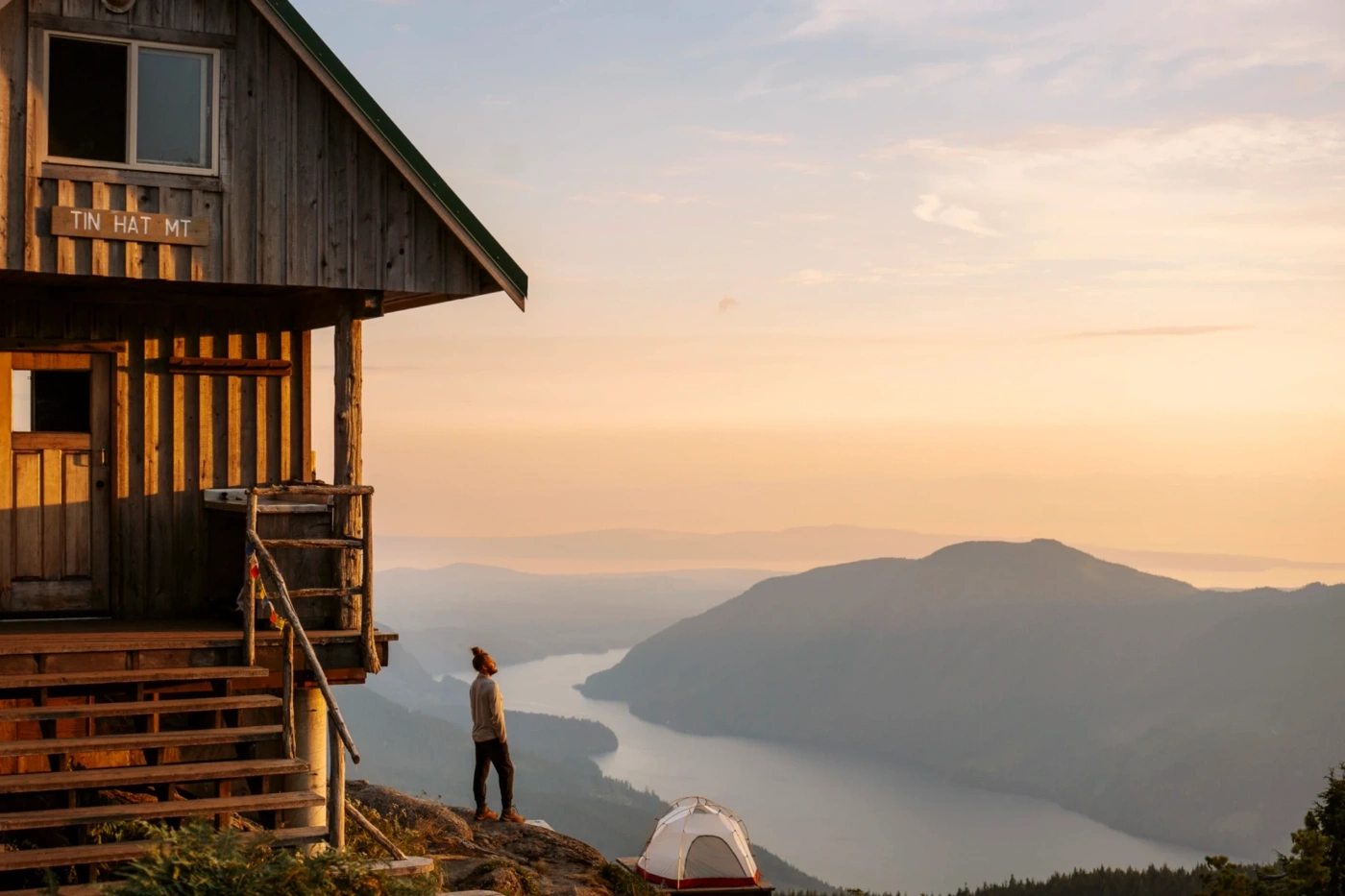
Why Hike To Tin Hat Hut

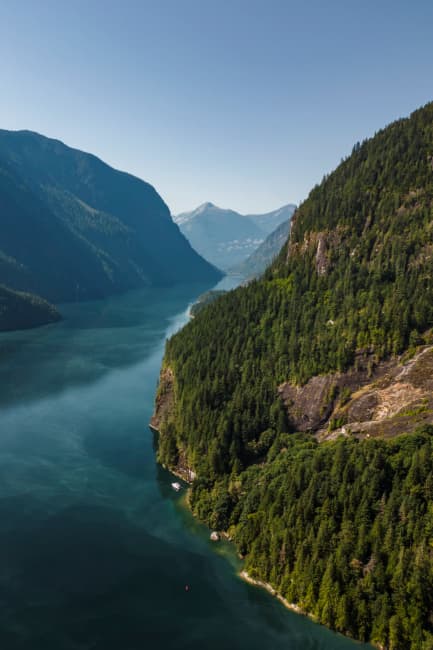
Tin Hat is the crown jewel of the Sunshine Coast Trail. The climb isn't long, but the payoff is a rare, truly 360° panorama that sweeps across mountains, inlets, and islands. At the top, there is the most photogenic hut on the whole trail, perched right on the ridge. Sunset, sunrise, and stars all put on a show.
Also, if you're lucky, you might wake up above a cloud. It's common to get cloud inversion blow-through and struggle to reach the heights of the hut. The result is looking out to a sea of clouds in every direction, with only the most pronounced peaks sticking their noses through in the distance.
What to Do at Tin Hat Hut


There is definitely not as much to do here as some backcountry sites in BC. No lake; most of the trails are longer continuations of the SCT, and the cell service is unreliable. BUT the views hit in every direction. There are small paths you can wander around by the camp, and there are plenty of lookout points, benches, and picnic tables to post up at.
The big thing to do here is climb to the summit for sunset. When we camped here, there were around 20 or so other people also camping, and we all made our way up the last stretch together as if it were an instinctive migration.
The sunset from the top is incredible. First the soft gold light casts a warm glow on the far peaks to the east and the lakes below, then as the sun sinks lower the clouds to the west turn wispy and orange, and after the sun dips beneath the western peaks the after glow as the sun makes its way to the true horizon gives the whole mountaintop a dreamlike filter for you hike back to camp.
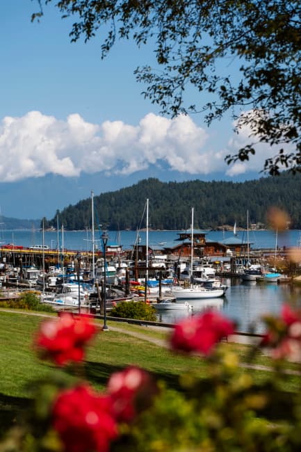
Where To Stay Near Tin Hat Hut
If you don't want to camp at the top, or are looking for a place to stay before or after the hike, Powell River is your best option. This is a cute cabin option just outside of town. Or Waterways is a solid boutique hotel option right by the ferry. You can browse other options in the area here.
When to Visit Tin Hat Hut


Summer and early fall are best for hiking Tin Hat Hut. Trails are clear, the weather is mostly dry, and the days are long. Spring can be muddy, and winter brings snow and icy trails. The hut would be magic in the winter, but getting up there is for experienced hikers only. The same goes for the early spring. Before all the snow melts, it can be challenging to even get to the trailhead.
Final Thoughts

Tin Hat Hut can be as casual or significant a destination as you want. If you have a reliable off-road car, you can get up and down in a few hours. But if you choose to spend the night, you will probably meet people who've been hiking the SCT for days and arriving at the hut has a whole different meaning to them.
FAQ
What is Tinhat Hut?
How do I get to Tinhat Hut?
Do I need a special vehicle to reach the trailhead?
Is Tinhat Hut first-come, first-served?
Are there water sources or cell service?
What is the difficulty of the hike?
Are there safety tips for the service roads?
What should I do at Tinhat Hut?
When is the best time to visit?
Can I do Tinhat Hut as a day trip?
Our Trusted Travel Partners
We only recommend products and services we personally use and trust.

SafetyWing
Travel medical insurance for nomads and remote workers
Booking.com
Find the best deals on hotels, apartments, and vacation rentals
AllTrails
Discover hiking trails with detailed maps and reviews
Surfshark
Secure VPN for safe browsing and accessing content worldwide
Get Your Guide
Find the best deals on tours and experiences
Airalo
Prepaid SIM cards for travelers
Trusted Housesitters
Find free accommodation by house and pet sitting worldwide
Wise
Send and receive money internationally with low fees* We may earn a commission when you make a purchase through our affiliate links, at no extra cost to you. We appreciate this support, which helps sustain our blog and allows us to create more content and help more great trips get planned!