
Al's Habrich Ridge Trail Stats
| Distance | Elevation | Time | Type | Difficulty |
|---|---|---|---|---|
| 7 km | 410 m | 3 h | out and back | hard |
Trail Map
Getting To The Trailhead


Step 1 is getting up the Sea-to-Sky Gondola. The Gondola is right off the highway south of Squamish, and you have the option of riding the gondola up or hiking. Al's Habrich is already a pretty challenging trail, so unless you're an experienced hiker and you're trying to train for something, I would definitely recommend taking the ride, because the hike up to the Summit Lodge is quite demanding.
Lift Ticket Pricing
| Customer | Price ($) |
|---|---|
| Adult (19-64) | 81.95 |
| Senior (65+) | 76.95 |
| Youth (13-18) | 51.95 |
| Child (6-12) | 37.95 |
| Family of 3 (2 Adults 1 Child/Youth) | 191.95 |
| Family of 4 (2 Adults 2 Child/Youth) | 191.95 |
| Annual Membership | 219 |
Once you're up top, to find the trailhead, walk the forest service road toward the Wonderland Lake Loop and keep going past that trailhead. Within about 5 minutes of leaving the gondola area, you'll spot the sign and a narrow trail cutting into the forest. Easy to miss if you're not looking for it, but once you know it's there, it's obvious.
How Hard Is This Hike?


This is a challenging one. The terrain varies constantly: rooty and rocky forest sections, exposed stretches where you're walking across bare rock slabs, and everything in between. It's not a long hike, 2.5 to 3.5 hours depending on your pace and how long you linger at the viewpoints, so it's not going to test your endurance the way a full-day slog would. But don't mistake short for easy. This is proper backcountry terrain the whole way, and it demands your attention.
There's about 400m of elevation gain packed into the trail. The first 10 minutes or so are relatively flat, winding through forest, and then it's pretty much uphill the entire way until you crest the ridge.
The Viewpoints


Almost immediately after you've finished the climb, you come out into a stretch with several viewpoints, big, obvious, exposed stone slabs that are impossible to miss.
As you approach the main viewpoint, you'll notice a steep exposed rock face off to the right with a small trail leading up to it. It looks intimidating from below, but the rock has a nice grippy texture, so it's more manageable than it appears. You'll probably use your hands a little to get up, but it's safe, and it's completely worth the effort.
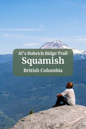
The views from the top of that rock are the best on the entire trail. You get a clear shot of Howe Sound to the left, the whole Squamish Valley spread out in front of you, and a genuinely stunning view of Mount Garibaldi to your right. On a really clear day, you can even pick out the tip of Black Tusk poking up above the surrounding peaks.
Should You Continue To Neverland Lake?

Past the viewpoints, the trail keeps going for about 2 km to Neverland Lake. This stretch is flat, winds through a really pretty section of forest, and even has a nice boardwalk section partway through. Honestly though, you can turn around after the viewpoints and not miss much.
The viewpoints were the highlight for me, and the lake was a bit of a letdown. By July it's more of a puddle than a lake, and the waterfall it drains into is nothing more than a disappointing little trickle.
That stretch to the lake is the easiest part of the whole trail, so if you're a completionist, or just curious, it's not a hard detour to make. But I've only been out to the lake once. Every time since, I just take a break at the viewpoints and head back down from there.
Following The Trail


The AllTrails route is straightforward, and the trail itself is well marked the entire way.
If you look at the embedded AllTrails map below, you'll notice a little loop about a third of the way up, where the trail splits and rejoins a bit further along. AllTrails will suggest taking the left fork on the way up and the other on the way down, and that's the better way to do it, though either direction works fine.
The one thing worth knowing: the left option, on the way up, has a short rope section. Two ropes are bolted into the rock face to help you climb over a couple of steep spots.
The right option is a gentler climb on a dirt trail instead. You can use the ropes to help you descend too if you want, but if that sounds intimidating, just stick to the right-hand route both ways and skip the ropes entirely.
Watch Out For The Heat
One of the bigger challenges on this hike isn't the elevation, it's the sun. There are several exposed sections where you'll be climbing steep terrain with zero shade cover. If you're used to hiking around Squamish, you've probably been spoiled by how much shade most trails offer, so this one will catch you off guard if you're not prepared. Pack more water than you think you'll need, and wear a sunhat. It makes a bigger difference than you'd expect.
FAQ
How hard is Al's Habrich Ridge Trail?
Do you need to hike up to the Sea to Sky Gondola summit before starting this trail?
Does Al's Habrich Ridge Trail have any rope or scramble sections?
Is it worth hiking to Neverland Lake on this trail?
What is the view like from the top of Al's Habrich Ridge Trail?
Our Trusted Travel Partners
We only recommend products and services we personally use and trust.

SafetyWing
Travel medical insurance for nomads and remote workers
Booking.com
Find the best deals on hotels, apartments, and vacation rentals
AllTrails
Discover hiking trails with detailed maps and reviews
Surfshark
Secure VPN for safe browsing and accessing content worldwide
Get Your Guide
Find the best deals on tours and experiences
Airalo
Prepaid SIM cards for travelers
Trusted Housesitters
Find free accommodation by house and pet sitting worldwide
Wise
Send and receive money internationally with low fees* We may earn a commission when you make a purchase through our affiliate links, at no extra cost to you. We appreciate this support, which helps sustain our blog and allows us to create more content and help more great trips get planned!