
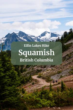
Elfin Lakes Hike in Squamish: Key Points

- Distance: about 22 km round trip, roughly 800 m of total elevation gain
- Moving time: around 4.5 hours if you're quick, 5 to 7 hours for larger or slower groups; budget a full day either way
- Difficulty: long and steady, but not technical, no ropes, no scrambling, just a gradual, consistent climb
- Trailhead: Diamond Head Parking Lot, about a 10 km drive up a rough forest service road past the pavement's end
- Parking: free and first come, first served Tuesday to Thursday
- Day passes: required Friday through Monday, free, bookable up to 3 days ahead
- Overnight camping: 35 tent pads plus a shelter, right along the ridge with views of Garibaldi Provincial Park
- Watch out for: overnight vehicle break-ins at the trailhead, and muddy sections on the narrower trail split right after Red Heather shelter
How To Get To The Trailhead

Getting to the trailhead is a pretty fun and classic Squamish experience, and honestly it matches the vibe of the hike perfectly. It's the perfect way to dip your toe into classic Squamish outdoor rec without getting in way over your head.
To get there you'll head up Mamquam Road in the Garibaldi Highlands. Just past the university, the road stops being paved and is renamed Garibaldi Park Road, and starts to climb and wind its way up the mountainside.
From where the pavement ends to the trailhead is about a 10 km drive, and it'll take you 20 to 30 minutes depending on what you're driving and how much you care about it.
The first 5 km are pretty smooth sailing, nicely maintained with no big rocks or potholes. Around the halfway point you'll pass by a few houses that are part of an off-grid community, and past that, the road gets noticeably worse.
Last time I did this hike, I followed a little Volkswagen Golf with next to no clearance up (I was in a Forester), and the Golf took it pretty slow, but made it up just fine.
Past the off-grid community, there's about 3 km of smooth road riddled with big potholes. You can dodge most of them by swerving around, but in a few sections you'll just need to slow right down.
The last 2 km are the roughest part of the drive. It's the steepest stretch too, and the road is really just a rocky path shooting straight up to the parking lot. There's a small lot at the start of this stretch if you'd rather not put your car through it. The little Golf I followed handled it fine, but shaking around like that can feel a bit like you're on the space shuttle during re-entry.
Parking & Day Passes

The parking lot itself is a big dirt lot with clearly marked spaces. There's a big billboard at the trailhead with all the info you need before heading out, and a few well-maintained pit toilets right there too.
Parking is free and first come, first served Tuesday through Thursday.
From Friday through Monday, you'll need to book a day pass, which you can do up to 3 days in advance. Passes are free, but BC Parks caps the number of hikers to prevent ecological damage and to keep the parking situation from turning into chaos. There are a fixed number of passes released each day, and cancelled passes do get released back into the pool, so it's worth checking back if the day you want looks full.
The lot stays pretty consistently busy. There are 35 tent pads plus the shelter at the top, so on most nights there are plenty of cars staying overnight. Those clear out mid-morning and early afternoon, but get steadily replaced by new campers and day trippers. Midweek, the lot is always busy, but I've never had trouble finding a spot.
One thing worth knowing before you go: theft is a common issue at this trailhead. It usually happens overnight, people coming up in the dark and smashing windows to grab whatever they can find. It's a pretty crummy thing to come back to after a night of camping, so don't leave anything valuable or irreplaceable in your car overnight. It's much less likely if you're just out for the day, but I still wouldn't leave a family heirloom sitting in there.
The Hike


This is a long one. About 22 km round trip with roughly 800m of total elevation gain, and it's a steady grind the whole way. These are some serious stats, and they'll test your endurance, but the terrain itself is really manageable, so you can set the pace you're comfortable with. If you take it slow and steady, it's doable even for pretty beginner hikers.
The trail is a wide dirt path with lots of stones the entire way, no rope sections, nothing especially steep, no big steps up natural rock staircases. It's just a gradual ramp snaking up the mountainside. It's so gradual and consistent that it's actually a popular mountain biking route, a punishing climb up, but ripping back down with gravity on your side is an absolute ball.
Last time I hiked up, I was solo with my headphones on, keeping a pretty quick pace, and my moving time was around 4.5 hours round trip. Larger groups or slower hikers are probably looking at 5 to 7 hours moving time. You'll also want to build in plenty of time at the top, water breaks, and stops to just take in the view, so no matter your speed, you're realistically looking at a full day mission.
The trail itself starts out kind of uninteresting. From the parking lot, you're surrounded by trees with no real sense of where you are; then you head off from the trailhead, and it's immediately a steady uphill grind along a wide rocky path. You'll wind through the trees with no clear view of where you're going, but it's actually a decent way to start, since this section gets shade all day, which makes the grind more tolerable. Early on you'll pass a small waterfall and a little lookout down onto Howe Sound and downtown Squamish. It's a nice view and helps you get oriented, but it's really nothing compared to what's coming.
The forest, the shade, and the slow incline continue until about 5 km in, roughly the halfway point to the lakes.
You'll know the forest section is nearly done when you spot the Red Heather day shelter on the side of the trail. It's a great spot to take a break, and there's a pit toilet just a little further past it.


Just past the pit toilet, the trail splits. Left is the hiking path, right is the mountain biking route.
The trail changes here; it stops being the wide, rocky, mountain-bike-friendly path and narrows into more of a dirt trail. Same steady incline, nothing technical, but it can get muddy, especially right after the snow melts.
This section is short, and after about 15 to 20 minutes it reconnects with the biking route, and the two merge back together for the final climb.
This is when things start getting good. Same wide path, same steady incline, but you're out of the forest now, and the views open up and stay good the rest of the way to the lake. You'll be circling around in a sort of squiggly semi-circle around Garibaldi Peak, and it's incredible watching it change subtly over hours as you move along the ridge. You're up around 1,600 m above the valley at this point, so you get sweeping views of all the mountains towering over Squamish Valley, plus the peaks and glaciers off on the other side in Garibaldi Provincial Park.

Once you're out in the exposed area, there's one final uphill push. From the highest point, right before you start descending onto the ridgeline, look off to your left, and you'll spot the Elfin Lake shelter (I'm pretty sure the one visible from there is actually the Rangers shelter, but it sits along the same lakes as the Elfin Shelter and the day use shelter).
From here you're on easy street. The trail is mostly flat or downhill along the ridgeline all the way to the lake, with incredible views the whole stretch, and the hiking gets a lot easier.
At The Lakes


Once you arrive, you'll walk past a little viewpoint where you can actually see both lakes at once, along with the Rangers' shelter. The trail continues past the first lake, and if you keep going straight, you'll end up at the Elfin Shelter, or you can turn off toward the day use shelter to reach the camping and day use area.

The day use area has a large wooden shelter with benches, tables, a big countertop, and a grey waste disposal area. It's really well maintained, and comes in handy if you're trying to boil up some instant ramen in your Jetboil on a windy day. Next to it are two pit toilets on one side, and on the other, two outdoor picnic tables looking out at the lake, plus four bear hangs where campers can safely store food overnight.

The smaller lake next to the day use area is designated as the drinking water lake, so no swimming there. Some people drink straight from it, but BC Parks recommends treating or boiling your water before you drink it.
Right next to the day use area is one of the coolest backcountry campsites in BC: 35 wooden tent pads built up along the edge of the ridge, looking straight out at a dozen-plus stunning peaks and several massive glaciers in Garibaldi Provincial Park.
From the day use area, a few small trails lead up a little hill where you can get an even better view of the lakes themselves, worth the extra few minutes if your legs have anything left in them.
Final Thoughts

Elfin Lakes is long, but it's not technical, and that combination is exactly what makes it such a good "first hard hike." You get a full day of steady climbing, some stunning alpine views once you clear the trees, and one of the best backcountry campsites in BC waiting for you at the end, all without ever needing to scramble over rocks or pull yourself up a rope.
If you do this one and find yourself wanting something with a bit more bite, Wedgemount Lake and Watersprite Lake are both good next steps. Check out our Wedgemount Lake guide and our Watersprite Lake guide for the breakdown on each.
FAQ
How hard is the Elfin Lakes hike?
Do you need a permit for Elfin Lakes?
How long does the Elfin Lakes hike take?
Is the road to the Elfin Lakes trailhead rough?
Can you camp overnight at Elfin Lakes?
Our Trusted Travel Partners
We only recommend products and services we personally use and trust.

SafetyWing
Travel medical insurance for nomads and remote workers
Booking.com
Find the best deals on hotels, apartments, and vacation rentals
AllTrails
Discover hiking trails with detailed maps and reviews
Surfshark
Secure VPN for safe browsing and accessing content worldwide
Get Your Guide
Find the best deals on tours and experiences
Airalo
Prepaid SIM cards for travelers
Trusted Housesitters
Find free accommodation by house and pet sitting worldwide
Wise
Send and receive money internationally with low fees* We may earn a commission when you make a purchase through our affiliate links, at no extra cost to you. We appreciate this support, which helps sustain our blog and allows us to create more content and help more great trips get planned!